File:IffleyVillageMap.png
IffleyVillageMap.png (504 × 454 pixels, file size: 128 KB, MIME type: image/png)
Captions
Captions

|
Attribution information, such as the author's name, e-mail, website, or signature, that was once visible in the image itself has been moved into the image metadata and/or image description page. This makes the image easier to reuse and more language-neutral, and makes the text easier to process and search for. Commons discourages placing visible author information in images.
Indonesia | العربيَّة | Boarisch | беларуская (тарашкевіца) | বাংলা | català | čeština | Deutsch | Ελληνικά | English | español | eesti | فارسی | suomi | français | עברית | magyar | italiano | 한국어 | македонски | മലയാളം | Plattdüütsch | Nederlands | polski | português | português do Brasil | русский | sicilianu | slovenščina | Türkçe | 中文 | +/− |
| DescriptionIffleyVillageMap.png |
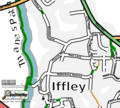
English: A map of Iffley Village in Oxford. Based on OpenStreetmap data, as of Sunday 3rd September 2006, and produced using OsmaRender |
| Date | 3 September 2006 (original upload date) |
| Source | Transferred from en.wikipedia to Commons by Stepshep using CommonsHelper. |
| Author | The original uploader was Gagravarr at English Wikipedia. |
| Permission (Reusing this file) |
This file is licensed under the Creative Commons Attribution-Share Alike 2.0 Generic license.
|

|
This city map image could be re-created using vector graphics as an SVG file. This has several advantages; see Commons:Media for cleanup for more information. If an SVG form of this image is available, please upload it and afterwards replace this template with
{{vector version available|new image name}}.
It is recommended to name the SVG file “IffleyVillageMap.svg”—then the template Vector version available (or Vva) does not need the new image name parameter. |
Licensing[edit]
| DescriptionIffleyVillageMap.png |
OpenStreetMap cut-out (or derivative work based on it): |
| Date | missing, probably the upload date |
| Source | OpenStreetMap project data |
| Author | OpenStreetMap contributors |
| Permission (Reusing this file) |
All OpenStreetMap data and maps are licensed under: This file is licensed under the Creative Commons Attribution-Share Alike 2.0 Generic license.
|
Original upload log[edit]
- 2006-09-03 16:09 Gagravarr 504×454× (134837 bytes) A map of Iffley Village in Oxford. Based on OpenStreetmap data, as of Sunday 3rd September 2006, and produced using OsmaRender
File history
Click on a date/time to view the file as it appeared at that time.
| Date/Time | Thumbnail | Dimensions | User | Comment | |
|---|---|---|---|---|---|
| current | 14:58, 17 March 2012 |  | 504 × 454 (128 KB) | Yjenith (talk | contribs) | Watermark is removed. |
| 18:51, 1 April 2009 |  | 504 × 454 (132 KB) | File Upload Bot (Magnus Manske) (talk | contribs) | {{BotMoveToCommons|en.wikipedia|year={{subst:CURRENTYEAR}}|month={{subst:CURRENTMONTHNAME}}|day={{subst:CURRENTDAY}}}} {{Information |Description={{en|A map of Iffley Village in Oxford. Based on OpenStreetmap data, as of Sunday 3rd September 2006, and p |
You cannot overwrite this file.
File usage on Commons
The following 2 pages use this file:
File usage on other wikis
The following other wikis use this file:
- Usage on en.wikipedia.org
- Usage on nl.wikipedia.org
Metadata
This file contains additional information such as Exif metadata which may have been added by the digital camera, scanner, or software program used to create or digitize it. If the file has been modified from its original state, some details such as the timestamp may not fully reflect those of the original file. The timestamp is only as accurate as the clock in the camera, and it may be completely wrong.
| PNG file comment |
|
|---|---|
| Horizontal resolution | 28.35 dpc |
| Vertical resolution | 28.35 dpc |
| File change date and time | 14:58, 17 March 2012 |
